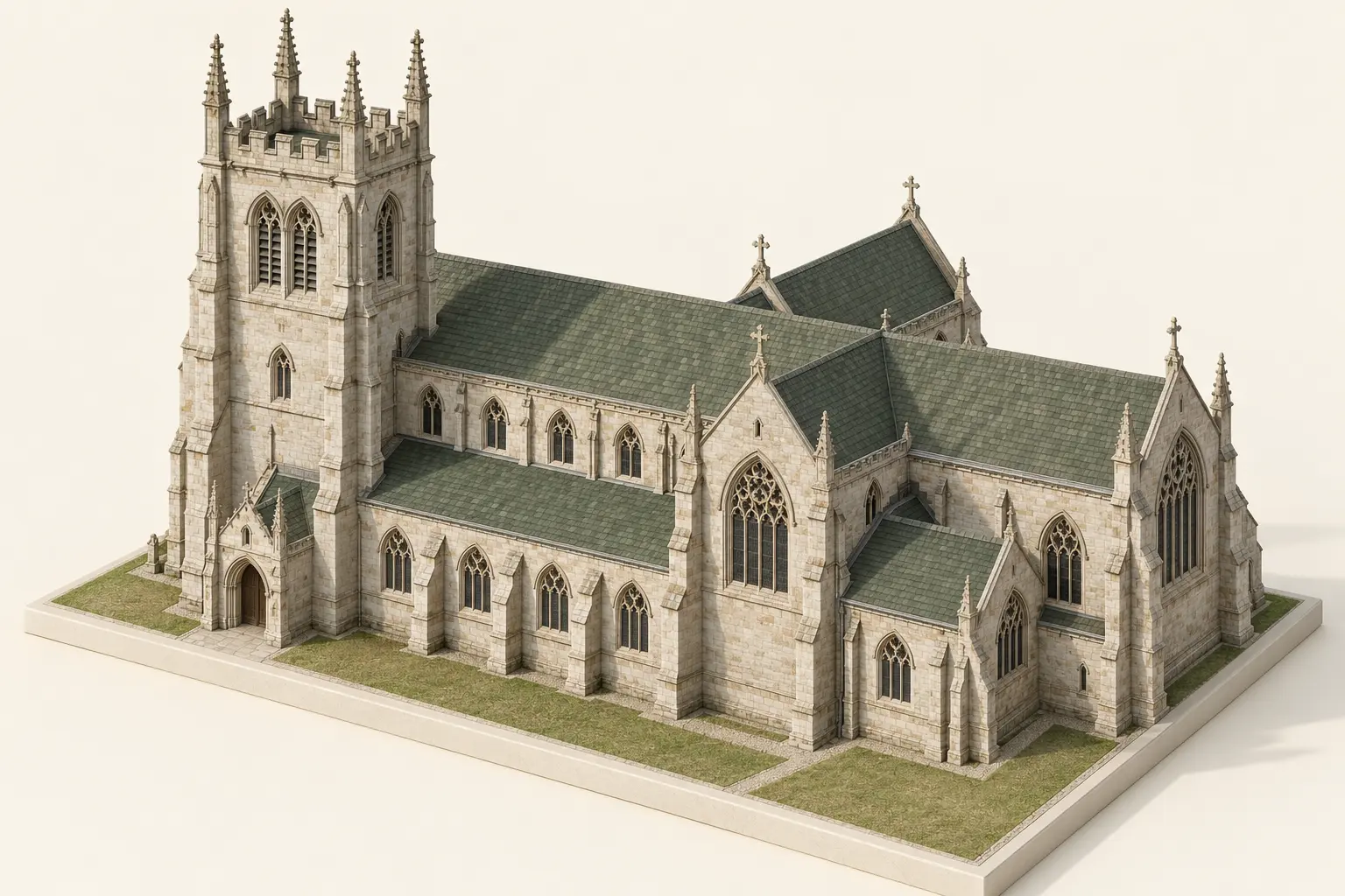
A detailed survey-based 3D model was developed to represent the intricate geometry of a historic structure.
Terrestrial laser-scan and drone-based point-cloud information were interpreted together to resolve complex architectural features and prepare coordinated geometry for downstream environmental assessment.
Project challenge
Translating irregular historic fabric into usable geometry.
Historic buildings rarely conform to simple, repeated forms. The work required considered interpretation of ornate features, varied roof geometry and areas captured differently across multiple survey sources.
Typical inputs
Multiple complementary survey sources.
Registered terrestrial laser-scan data
Drone-based point-cloud information
Supporting drawings and survey notes
Project coordinate and level information
Defined analytical modelling requirements
Technical workflow
Coordinating survey sources around complex geometry.
Review the sourcesAssess terrestrial, drone and supporting survey information together.
Establish coordinationConfirm the shared position, level information and modelling extents.
Interpret featuresResolve roofs, façades and intricate architectural forms from the available data.
Model the structureBuild controlled AutoCAD 3D solid geometry around the agreed purpose.
Cross-check geometryCompare the model with both survey sources and record limitations.
Prepare outputsDeliver coordinated geometry for downstream environmental assessment.
Technical scope
Complex survey geometry.
Terrestrial and drone point-cloud interpretation
Complex feature modelling
AutoCAD 3D solids
Geometry review across survey sources
Environmental-analysis geometry
MBS workflow support
Outputs & deliverables
A coordinated historic-structure model.
Analysis-ready three-dimensional model
Detailed historic geometry
DWG/CAD deliverables
MBS-compatible or agreed model files
Technical diagrams where agreed
Recorded source limitations and observations
Outcome
Accurate geometry for downstream assessment.
Delivered an accurate analysis-ready model of complex historic geometry, integrating terrestrial and drone survey information to support downstream environmental assessment.