04 · Selected work

Portfolio

Selected examples demonstrating the range of technical work and professional experience behind CAD Services Studio—from survey-based geometry and complex modelling to environmental analysis and independent technical review.

Certain project examples have been anonymised to protect client confidentiality. Client names, project names, precise locations and other identifying information have therefore been omitted.

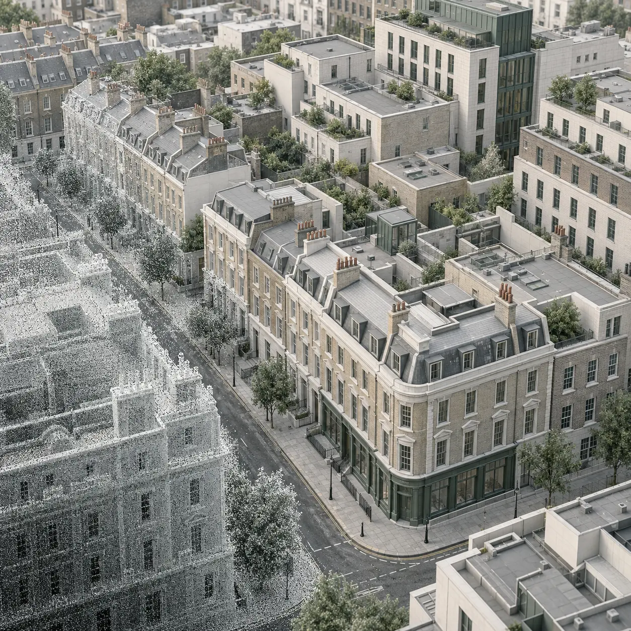
Illustrative anonymised London urban context transitioning from registered point-cloud data into coordinated three-dimensional geometryProject 01 · Urban Context Modelling

Urban context modelling

City Centre Development — 3D Modelling & Analysis

A detailed 3D model was developed from point cloud survey data to support daylight, sunlight and rights of light analysis within a dense urban environment. The project involved modelling complex surrounding context and constrained site conditions to produce reliable analysis-ready geometry using AutoCAD and MBS software.

View technical scope

Technical scope

  • Terrestrial and drone point cloud input
  • 3D solid modelling in AutoCAD
  • Analysis-ready model output
  • Survey-based geometric precision

Services provided

  • Point cloud interpretation
  • Urban context modelling
  • Geometry preparation for analysis
  • MBS workflow compatibility

OutcomeDelivered a reliable and contextually accurate 3D model enabling robust analysis within a complex urban setting.
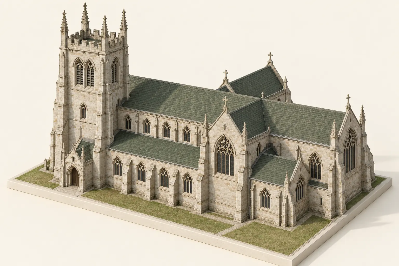
Illustrative survey-style model of a historic churchProject 02 · Complex Heritage Geometry

Complex survey geometry

Heritage Structure — Analytical Modelling Study

A detailed survey-based 3D model was developed using terrestrial laser scan and drone-based point cloud data to support daylight, sunlight and rights of light assessments of a complex historic structure.

The project demonstrates expertise in integrating multiple survey data sources and modelling intricate architectural geometry to produce analysis-ready models using AutoCAD and MBS software.

View technical scope

Technical scope

  • Terrestrial laser scan and drone capture
  • AutoCAD 3D solids
  • MBS analysis support
  • Contour plots and technical diagrams

Services provided

  • Complex feature modelling
  • Environmental-analysis geometry
  • Rights of Light assessment support
  • Technical output generation

OutcomeDelivered an accurate analysis-ready model of complex historic geometry, integrating terrestrial and drone survey information to support downstream environmental assessment.

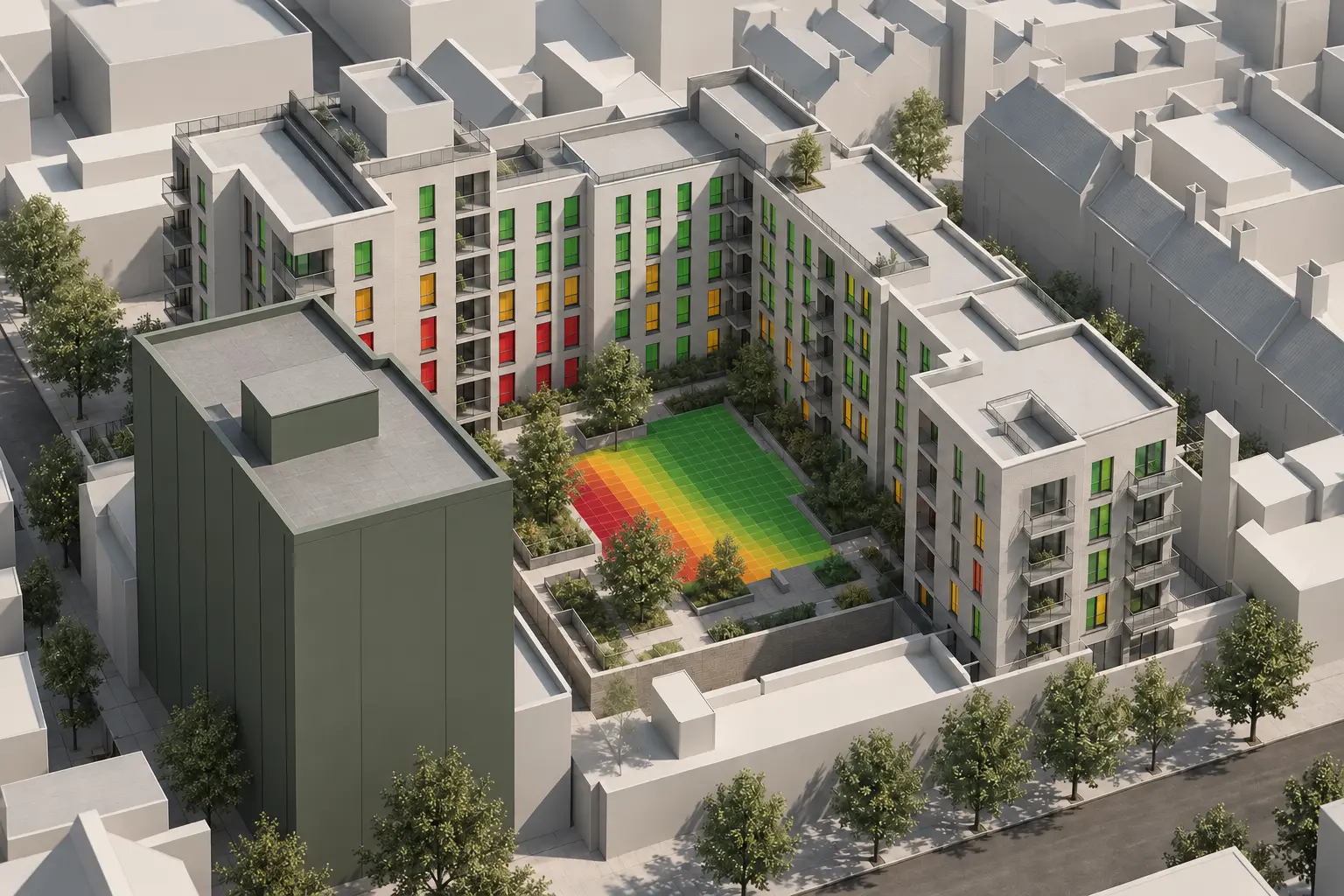
Illustrative anonymised urban residential model with a proposed mass, related window-level impacts and a SHOG assessmentProject 03 · Daylight, Sunlight & SHOG

Daylight & Sunlight Analysis

Urban Residential Scheme — Daylight, Sunlight & SHOG Assessment

Survey-based model coordination and environmental analysis were undertaken for a residential development within a dense urban setting. The scope included modelling from point cloud survey data, coordinating and reviewing the 3D geometry, registering and preparing the analytical model within MBS, and undertaking Daylight & Sunlight and Sunlight Hours on Ground (SHOG) assessments.

View technical scope

Technical scope

  • Point cloud survey data
  • Survey-based 3D model coordination
  • Geometry review and preparation
  • MBS model setup and registration
  • Daylight & Sunlight assessment
  • Sunlight Hours on Ground (SHOG)
  • Analysis output review

Services provided

  • Point cloud interpretation and modelling
  • Model checking and coordination
  • Analysis-ready geometry preparation
  • MBS workflow and model registration
  • Daylight & Sunlight analysis
  • SHOG assessment
  • Technical output preparation

OutcomeDelivered a coordinated analysis model and supporting technical assessment outputs for the evaluation of daylight and sunlight conditions within a complex urban residential environment.

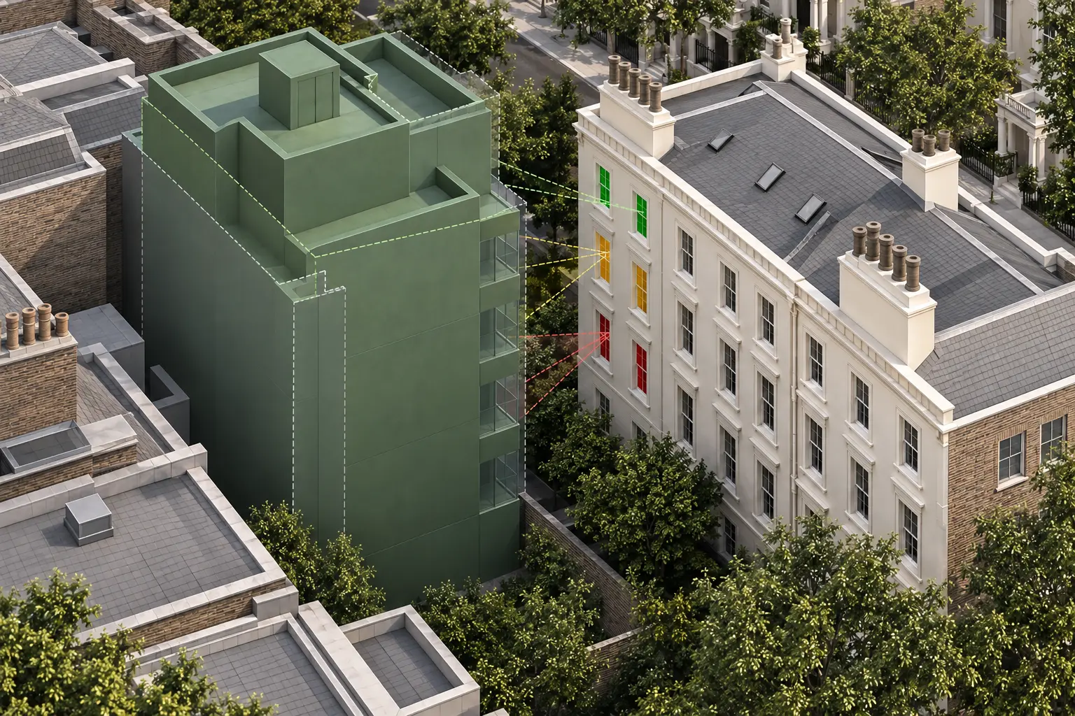
Illustrative anonymised Rights of Light model review showing affected windows opposite a solid proposed massProject 04 · Rights of Light Technical Review

Rights of Light Technical Advisory

Adjoining Owner Rights of Light — Technical Review & Negotiation Support

Technical Rights of Light support was provided in relation to a proposed neighbouring development affecting an adjoining residential property. The instruction involved reviewing third-party technical information and 3D model data, checking the analytical geometry and relevant modelling assumptions, and undertaking Rights of Light analysis to establish the extent of potential loss of light.

The technical findings were then used to support discussions with the development team and their advisers, including the review of analysis results, identification of technical discrepancies and consideration of revised information during the negotiation process.

View technical scope

Technical scope

  • Third-party technical information review
  • Third-party 3D model review
  • Geometry verification
  • Rights of Light analysis
  • Existing and proposed condition assessment
  • Loss-of-light evaluation
  • Review of analytical assumptions
  • Review of revised technical information

Services provided

  • Independent technical model checking
  • Rights of Light analytical review
  • Identification of modelling or analytical discrepancies
  • Interpretation of technical results
  • Technical support during negotiations
  • Coordination and review of information exchanged between parties

OutcomeProvided independent technical analysis and model review to establish a clear evidence base for Rights of Light discussions and support the negotiation process.

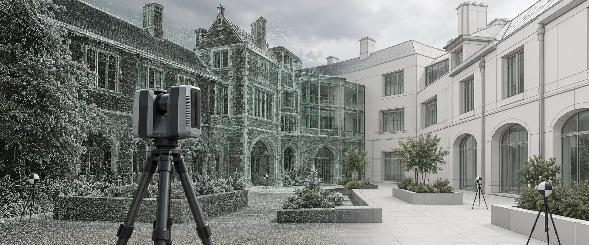
Illustrative anonymous terrestrial laser-scanning workflow transitioning from registered point-cloud data to coordinated CAD geometry

Previous Professional Experience

Reality Capture & Point Cloud Experience

In addition to analysis-ready 3D modelling, previous professional project experience includes on-site terrestrial laser scanning using the Leica RTC360 across complex urban building environments.

This experience covered the wider survey-to-model workflow, from carrying out scan positions on site through to scan registration, point-cloud processing and preparation of coordinated survey data for downstream CAD modelling and technical analysis.

Experience includes

  • On-site terrestrial laser scanning using Leica RTC360
  • Building and urban-context survey capture
  • Multi-position laser scan acquisition
  • Scan registration
  • Point-cloud processing
  • Review and quality control of registered survey data
  • Preparation of coordinated point clouds for CAD workflows
  • Point-cloud interpretation and 3D modelling
  • Integration of survey geometry into analysis-ready models
  • Downstream Daylight, Sunlight and Rights of Light workflows

This practical reality-capture experience provides a detailed understanding of the complete process behind survey-based modelling—from data acquisition in the field through to coordinated 3D geometry and technical analysis.